Rocket Trail for iPhone is a fantastic tool for any rocketeer! Now, you can simulate a launch of any Estes rocket in the palm of your hand, hit the launch site with this must-have tools.
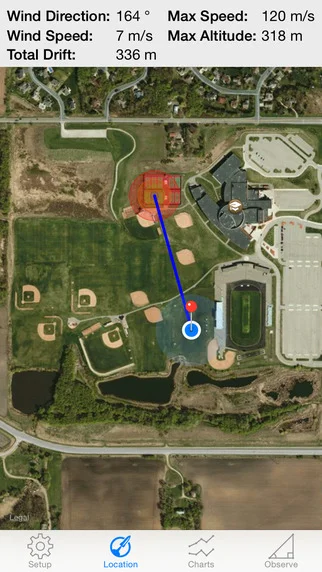
Rocket Trail allows you to select a rocket, parachute and engine, and it will calculate the projected altitude of your launch. Rocket Trail calculates the effects from weathercocking and drift to predict your rockets landing zone using current realtime weather data. How cool is that!
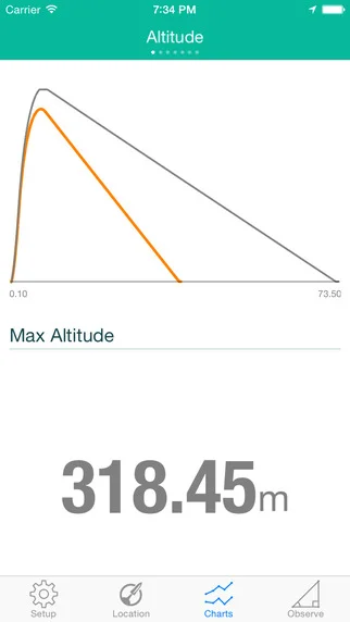
Dig into the data and examine the physics involved with your launch. View your rockets
. Altitude
. Velocity
. Acceleration
. Engine Thrust Curve
. Forces acting on your Rocket
. Drift effects from Wind
Rocket Trail can also be used to measure you rockets actual launch altitude. Set the location of your launch site and your distance is calculated using your GPS location. Augmented reality is used to help locate your rockets predicted launch altitude and display measurements.